24-Mile Railroad connecting Lexington to Lawrenceburg has trail potential

Original Name: “LL” branch of Louisville Southern (Lexington to Lawrenceburg)
Date Constructed: 1888-1889
Length: 24 miles
Location: The line runs through Fayette, Woodford, and Anderson counties.
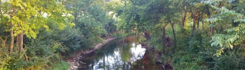
Highlights: Starting behind Rupp Arena and the Newtown Pike Extension, beside Town Branch Creek and the James E. Pepper Distillery, travels through beautiful thoroughbred horse country, behind Keeneland Race Course, through the village of Pisgah, to Versailles, crossing the Kentucky River on a breathtaking1659 foot long, 280 foot high structure at Tyrone called Young’s High Bridge, passes beside the Wild Turkey Distillery and ends in Lawrenceburg.
Historic highlight: Hauled thoroughbred horses in specially equipped cars to Keeneland, Calumet, and King Ranch.
Current ownership and conditions: The western-most 3 miles were in service until recently for the Austin Nichols Distillery (Wild Turkey) from Lawrenceburg; Young’s High Bridge has been closed to train traffic since 1985; a 5.5 mile “middle stretch” from the bridge running to Versailles has been operated by the Bluegrass Railroad Museum since 1987. The eastern-most 15 miles from Versailles to Lexington is actively owned and operated by RJ Corman.

Below is a history created by Emmett Bell:

The Louisville Southern (LS) began construction of its new railroad in Louisville, and proceeded in a east-southeast direction through Jefferson, Shelby, and Anderson Counties, reaching Lawrenceburg in mid-1888. Late in the same year, surveyors began plotting out a tortuous route (compared to the rest of the railroad) from Lawrenceburg, eastward towards Lexington. The last 24 miles of the railroad would require two large bridges, including a 1659 foot long, 280 foot high structure over the Kentucky River at Tyrone, as well as numerous steep grades, cuts, and sharp curves. LS president Bennett Young hired the Union Bridge company of New York to build the Kentucky River bridge, which had required Congressional approval to construct, and to oversee the project personally. Young was a well known person during this time, and was a highly regarded hero from the Civil War. He had planned and led one of the northern most actions of the war, when his band of raiders robbed a bank in St. Albans Vermont. After the war, Young became active in Reform politics in Kentucky, and was named the president of the Louisville Southern because of his numerous successful business ventures and political actions.
As construction on the Kentucky River bridge (now named Young’s High Bridge) continued, track crews pushed the line steadily towards Versailles, and a connection with the Versailles And Midway (V&M), which built a line between those two cities, and a branch to Georgetown, in 1885. The LS Finally reached its goal in early August when it established a connection with the Cincinnati Southern (Cincinnati, New Orleans & Texas Pacific) in Lexington. On August 21st, 1889 a special train departed Louisville and made it’s way to the east end of Young’s High Bridge, where the ceremonial last spike was driven, and then proceeded to Lexington with Federal, State, and local officials on board. The Louisville Southern was finally a reality.
Shortly after completion, the LS acquired the V&M, and began making improvements on the hastily constructed mainline. Not unlike many of the new railroads of this era, the LS started to suffer from financial woes, and ended up in receivership in the fall of 1889. The line was leased to the Louisville, New Albany and Chicago (MONON) on October 14, 1889, and this would prove to be the first of several different reorganizations of the railroad. After a stockholders revolt, the line came under the control of the East Tennessee, Virginia, and Georgia Railroad (ETV&G), which was later absorbed by the Southern Railway in Kentucky, and finally the Southern Railway System.
The line prospered, with several scheduled passenger trains a day, and an ever increasing amount of freight traffic. The Southern Railway took over operations of the CNO&TP between Cincinnati and Chattanooga, and began running regular passenger trains between St. Louis, Louisville, Lexington and points South.
As traffic increased, the portion of the railroad between Lawrenceburg and Lexington began to be a bottleneck, with its uneven topography and curves, and the Southern began construction of a upgraded line from Lawrenceburg, south through Harrodsburg, to a point north of Danville (SJ Tower) where it connected to the CNO&TP. All passenger traffic, and most of the freight traffic was routed via the new “Lawrenceburg cut off”, and the 24 miles from Lawrenceburg to Lexington became the “LL” branch. Traffic remained moderate over the line for the next several decades, with large amounts of coal being brought to the Kentucky Utilities steam plant at Tyrone, and other local traffic for online customers. Thoroughbred race horses were also handled across the line in specially equipped cars, being moved in and out of the Keenland race track, and from Calumet and other horse farms near the railroad. A special spur and loading ramp was constructed at Kings Ranch (MP 20.0LL), behind Calumet Farm to serve this business.
In the early 1980’s, coal traffic began to decline, and was suspended in 1984. The loss of the coal business, plus the ever worsening condition of Young’s high Bridge and the track in general, forced the closing of the “middle” 5 1/2 miles of the branch. The last train crossed the bridge in August of 1985, bringing to a close 117 years of continuous service on the old LS.
The western 3 miles of the line were left intact to allow service to the Austin Nichol’s distillery (makers of Wild Turkey Bourbon Whiskey), and the out of service portion between the east end of the Kentucky River bridge and MP 9.0LL was sold to the Bluegrass Railroad Museum in 1987 for tourist train operations. Norfolk Southern still retained the eastern 14 miles between Versailles and Lexington to serve several customers in Versailles. NS train K-21 and K-22 made the trip to Versailles 5 days a week until the traffic levels became too low for NS to justify operation. The line was sold to Gulf And Ohio Railways, and on May 11th, 1996, a newly formed G&O subsidiary, the Lexington & Ohio Railroad began operation of the line.

History compiled and written by Emmett Bell.

Another perspective on why Lexington needs Town Branch Trail

The Creative Class- trail is a vital asset for attracting and retaining the workforce of the new creative economy.

What is driving the growth of the nation’s most successful communities today?
According to Richard Florida, a Carnegie Mellon Economics Professor who recently participated in Lexington’s IdeaFestival, the driving force behind the nation’s dynamic growth is the role of creativity in our economy and society. No longer driven by traditional trade routes or smokestack industries, the U.S. economy is now being fueled by a constant process of invention and innovation. The ‘Information’ or ‘Knowledge’ based economy in which we now live and work is growing and changing constantly due to the dynamic influence of a category of people whom Florida calls the ‘Creative Class’. This creative sector of the population has grown dramatically over the last few decades to where it currently accounts for over 30% of the work force. Most important, however, it the fact that this category of creative professionals is now responsible for the vast majority of growth in the U.S. economy. The highly educated and highly skilled individuals whom Florida defines as the ‘Creative Class’ are professionals in core areas of Science, Engineering, Architecture, Design, Education, Arts, and Entertainment, and in the supporting fields of Business, Finance, Law, Health Care, and Management. It naturally follows that the places experiencing the greatest economic growth in the nation are communities with a high concentration of this ‘Creative Class’. What is surprising, however, is that this ‘Creative Class’ is not staying in the traditionally largest or most populous locations. It is migrating to areas of the country where the quality of life is highest. These are locations that have strong educational institutions, ample outdoor or recreational amenities, and vibrant arts and cultural venues. These are places that are open, diverse, and tolerant of a variety of religions, cultures, and ethnicities.

Why does this relate to Town Branch Trail?
Because the creative individuals that Lexington wants to attract and retain for its economic and cultural prosperity are people who use trails. Florida describes in his book, The Rise of the Creative Class, how over the last 40 years the demand for physical exercise has grown enormously for individuals who use their minds for a living. There is a close correlation between trail users and creative professionals. Data compiled by the Iowa Department of Transportation reflects that trail users are on average more educated and have higher incomes than average Americans. A brief survey of the most dynamic communities in the nation will show that greenway trails are an essential ingredient in making these new centers of prosperity attractive to the ‘Creative Class’ responsible for their success.

How does Lexington rate as a creative city?
For metropolitan areas of between 500,000 and 250,000 people, Lexington ranks #9 out of a listing of 63. For more information go to www.creativeclass.org and http://www.dot.state.ia.us/trails/.

Town Branch Trail Receives Environmental Project Approval

Lexington’s Town Branch Trail has recently received (April 2004) environmental authorization to proceed with construction. Under the National Environmental Policy Act (NEPA), any project receiving Federal funds must undergo an analysis of potential impacts to the natural or human environment. After a survey of the trail area by the Kentucky Transportation Cabinet – Division of Environmental Analysis, the Federal Highway Administration determined that the Town Branch Trail posed no significant impact to the environment (e.g., no federally listed endangered plant species running buffalo clover was found). As a result of this approval, the Town Branch Trail takes another step forward.

How does Lexington measure up for its trail system?

Where do we stand in our efforts to provide Lexington with Greenway trails? As an ongoing feature of our newsletters, we will look at benchmark cities and compare our efforts with those of other cities around the country.

Lexington versus Chattanooga, Tennessee

POPULATION
Chattanooga 155,554
Lexington 260,512
Lexington is 67% larger

MEDIAN AGE
Chattanooga 36.8 years
Lexington 33 years
Lexington’s population is 10% younger

HOUSEHOLD INCOME
Chattanooga $32,006
Lexington $39,813
Lexington’s income is 24% higher

PERCENTAGE OF POPULATION WITH A BACHELOR’S DEGREE OR HIGHER
Chattanooga 21.5%
Lexington 35.6%
Lexington’s percentage is 65% greater

TRAILS
Chattanooga:
over 15 miles of paved trail with the largest trail being over 6 miles in length.
It runs into the center on the urban core.

Lexington:
approximately 13 miles of trail; 7 miles paved and 6 miles of grass trail. The largest continuous trail is 4 miles on grass at Masterson Station Park.

Despite the fact the Lexington is noticeably larger, younger, more prosperous, and better educated, Chattanooga,Tennessee has built more miles of trails and put together longer continuous distances.

Here’s the good news:
Under the Newberry Administration and the current LFUCG council Lexington has picked up the pace of trail planning and development dramatically. We can optimistically state that the trajectory we are on today will allow us to catch up with the successes of other benchmark cities.

To learn more about Chattanooga’s success log on to:

http://www.chattanooga.gov/cpr/greenways.htm
(This piece was written a few years ago and the totals for Lexington and Chattanooga have undoubtedly increased. We welcome any updated available.)

A GOOD BENCHMARK FOR TRAILS

From 1994-2003 the state of Tennessee received $168 million is transportation enhancements funding. Of those funds $121 million or 72% of the funds served bicycle and pedestrian improvements. During that same period the state of Kentucky received $132 million in TE funding and we spent $25 million on bicycle and pedestrian improvements or 18.9% of the total funds. Why the discrepancy? Why has Tennessee put a vastly greater emphasis on bicycle and pedestrian infrastructure? You might wonder how that squares with the national trend in TE funding. For FY 2004 the US will spend $290 million in TE funds. Of that 68% will go for bike/ped and rail/trail projects. Since we are one of the nation’s leaders in obesity and diabetes, wouldn’t you think we would be more committed to giving Kentuckians a way to exercise?

Note: Since this was written for a newsletter in 2005 Kentucky has raised its level of trail funding considerably. Let’s hope it continues.