Happy trails: Proponents say trails will be a big draw for city

• Lexington Herald-Leader Publication


Happy trails: Proponents say hiking, biking opportunities
will be a big draw for city

Jennifer Hewlett, The Lexington Herald-Leader, Ky.Apr. 20–For years, Lexington leaders have envisioned a system of interconnecting trails that would run throughout Fayette County, providing places for people to bike and hike — and possibly serving as a draw for tourists and others hoping to get an up-close look at the Bluegrass.

Those plans have generally been a path to nowhere.

But this might be the year when many Lexingtonians are able to start dusting off their bicycles and lacing up their sneakers.

Before the year is out, Lexington’s trail mileage should nearly double with the construction of 6.5 more miles of paved trail for bicycling, walking and other types of non-motorized use. The mileage, scattered throughout Fayette County in six planned trail sections, will bring the total number of trail miles in Fayette County to nearly 15.

And city leaders, who say Lexington lags behind other cities in
recreational opportunities such as trails, plan to spend more money on trail-building next year. So far, there are plans to build 4 miles of trail in Fayette County in 2008. An additional 13.6 miles are on the drawing board.

Mayor Jim Newberry has proposed spending $2 million for trails in the next city budget. City officials say that local money could be parlayed into $10 million in new trails if used to match federal grants.

Newberry said the renewed focus on trail-building could bring a lot of benefits to Lexington.

“In addition to recreation, they are economic-development tools, they
are paths to improved health and can even be alternative
transportation,” he said this week as the city put the finishing
touches on the first mile of the Brighton East Rail Trail. That route
runs from Bryant Road to Pleasant Ridge Drive in southeastern Fayette
County.

The mile-long section, which was paid for with $426,000 in federal funds and will be officially dedicated Sunday, is the first piece of trail built along an abandoned railroad corridor in Fayette County. The railroad abandonment runs from Lexington to just outside of Ashland.

“How can anybody not be for this?” said Lexington attorney Bill Gorton, who represents the Kentucky Rails to Trails Council, an organization that promotes turning abandoned railroad corridors into trails and greenways. “It is an absolute win-win for everybody, including neighbors.”

Trail sections to be built this year include:

— A second mile of the Brighton East Rail Trail, from Pleasant Ridge Drive to Deer Haven Lane, at a cost of $500,000.

— Town Branch Trail, 2 miles, from Long Branch Lane to Alexandria Drive, $550,000.

— South Elkhorn Trail, 1 mile, from Lockdale Terrace to Joseph Bryan Way, $200,000.

— Wellington Trail, a half-mile on Reynolds Road, from the traffic circle to the Shillito Park entrance, $150,000.

— Liberty Park Trail, a half-mile parallel to Flying Ebony Drive, $100,000.

— West Hickman Trail, a mile and a half, from Man o’ War Boulevard to Veterans Park, $1.5 million.

Construction is set to begin on the Liberty Park Trail section in the next couple of weeks. All of the trail projects planned for this year, which are being paid for with federal transportation dollars, should be complete before the end of the year, said Keith Lovan, a municipal engineer for the Lexington-Fayette Urban County Government who oversees local trail projects.

Trail proponents in Lexington point out that in other parts of the country, trails have led to an increase in tourism and the development of businesses along them, including bicycle shops and bed-and-breakfast inns.

“It actually increases the value of properties near or adjacent to
these trails,” Gorton said. “The people that use them are generally the kind of people you would want in your neighborhood.”

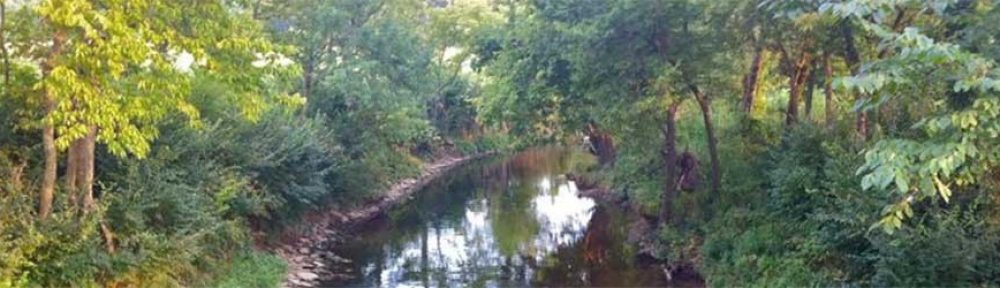
Van Meter Pettit, who has been working for years to get a trail built that essentially follows Town Branch of Elkhorn Creek, sees that particular proposed trail as more than something that would lead to health and economic benefits. He sees it as a way of restoring “dormant” history.

Lexington got its start along Town Branch, part of which now runs under Vine Street and emerges west of Rupp Arena.

“What happened was, the city was just a village — it was laid out on a creek, and then it outgrew the creek, and they kind of covered it up, bit by bit,” said Pettit, who is president of Town Branch Trail Inc. “A good century and a half of the city developed along the regular course of the creek.”

A half-mile section of Town Branch Trail, from Leestown Road to Long Branch Lane, opened in October 2005.

There is opposition to certain trail legs proposed for Lexington. Some people who live near proposed trail segments are concerned about loss of privacy and vandalism, Lovan said.

“It has proven not to be the situation,” he said. “A lot of times our biggest opponents become our biggest supporters.”

Kentucky is behind many states when it comes to trails. But several other cities and towns in the state, including Louisville, Bowling Green and Owensboro, have made a commitment to building them. Louisville, especially, has a good trail program, Lovan said.

“We have a plan for a 100-mile loop, known right now as the Metro Loop,” said Metro Louisville transportation planner Mohammad Nouri. Nineteen miles of the loop, which will encircle Jefferson County, are already in place. Construction is to begin on 8 more miles this summer, he said.

He said Lexington ought to be commended for the trails it’s building.

Lexington leaders hope to eventually have two major trail arteries —
one running north-south, from Veterans Park to the Kentucky Horse Park, and the other running east-west, from Masterson Station Park to Deer Haven Lane — to which neighborhood trailways would be connected. The exact routes for the north-south and east-west trails have not been determined, but three of the trail sections set to be built this year would be legs of the north-south and east-west trails, Lovan said.

“A lot of American cities have 20, 30, 60 miles of trails, and
Lexington is one of those great American cities that is catching up,” Pettit said. “Louisville sets a very high benchmark for us, and it’s a good thing. If we set our sights on emulating Louisville, then we’ll have a world-class trail system in no time.”If you go

——

The first section of the Brighton East Rail Trail will be dedicated at 2 p.m. Sunday in Pleasant Ridge Park. The event will include bike and pony rides, popcorn and prizes.

——

Lexington is getting 6.5 miles of biking and walking trails this year. The trail sections to be constructed are scattered throughout Fayette County.

Copyright (c) 2007, The Lexington Herald-Leader, Ky.

These archives are stored on a SAVE ™ newspaper library system from MediaStream Inc., a Knight-Ridder Inc. company.

Town Branch cloud

Herald Leader, Posted on Sat, Apr. 26, 2003

Why city tolerates an open sewer is real mystery

In what has become a rite of spring, the milky mystery cloud reappeared recently on Town Branch, signaling yet again that Lexington has turned this historic waterway into an open sewer.
Best guess, based on the titanium dioxide traces in the earlier slugs, is that the pollutant is latex paint.
City environmental engineer David Gabbard speculates that someone is cleaning paint buckets and brushes in an old mop sink or drain that was illegally connected to the storm sewers, probably years ago.
But illegal storm sewer connections are not the only way that raw sewage enters Town Branch.
The sanitary sewers also overflow into the creek. The main suspect is an overloaded underground system that serves the University of Kentucky, Ashland Park and Chevy Chase.
The overflows are a remnant of when municipal drainage systems were engineered to dump untreated sewage into storm sewers and streams during rains to prevent backups in houses.
Sewage overflows were installed along the 3-mile line in 1963. The sewer overflows and storm water go into an underground creek, buried about 100 years ago, that empties into Town Branch at Manchester Street.
Nowadays, heavy rain may not be required for the sewers to overflow. High fecal counts have been measured in Town Branch after dry spells. The city’s planning, environmental management and sanitary sewer divisions are investigating to pinpoint the problem’s sources and solutions.
Whatever the causes, the pollution of Town Branch with raw sewage is gross. It’s no less disgusting than the reviled mountain straight pipes. It’s also a violation of the Clean Water Act. The U.S. Environmental Protection Agency outlawed intentional sewer overflows in the 1980s.
Ending the sewage spills is on the city’s three-year, $23 million sewer improvement plan. But this upgrade is last on the list, behind projects that would relieve sewage backups in basements, yards and parks.
It’s hard to believe that in 2003 Lexington tolerates an open sewer just west of downtown. But the proof is there, in the mystery cloud that appears each spring to remind us of our environmental sins.

Trying out new trail


•
Lexington Herald-Leader Publication


Posted on Sun, Oct. 09, 2005with photos: http://www.kentucky.com/mld/kentucky/news/12856505.htm

TRYING OUT A NEW TRAIL

More than 100 test first leg of route at McConnell’s Trace subdivision

By Ryan Alessi

HERALD-LEADER STAFF WRITER

Road bikes, mountain bikes, strollers and scooters.

Wagons, wheelchairs, an old-time high-wheeler bicycle and even a homemade four-seater “quad” bike.

If it had wheels and wasn’t motorized, it probably was on the first leg of the new Town Branch Trail yesterday morning.

More than 100 Lexington residents attended the opening of the half-mile stretch of asphalt that winds behind the McConnell’s Trace subdivision. That new section hooks up to a trail that runs through Masterson Station Park, just across Leestown Road.

“We could not be more grateful and excited that this day has finally come,” said Van Meter Pettit, president of Town Branch Trail Inc.

By next year, Pettit said, he hopes the trail will extend a mile and a half farther, to Alexandria Drive — a key step to connecting the community through trails.

The long-term plan, he said, is to have trails linking the Kentucky Horse Park and the University of Kentucky’s Coldstream research campus, off Newtown Pike, to Masterson Station Park and the Town Branch Trail.

“What if we could connect our tourist destinations with trails so people can be bicycle tourists instead of riding in station wagons?” Pettit mused.

Bike enthusiasts are pushing for precisely that.

“We hope Lexington will get to the point of other residential cities, where you can commute on the trails and off of the roadways,” said Wendy Trimble, who with husband Mark owns Pedal the Planet bike shop.

The store’s employees as well as some from another bike shop, Pedal Power, offered bike safety checks at yesterday’s event.

“There’s fabulous riding in the Bluegrass area, especially around the horse farms,” Trimble said. “But the city itself needs more infrastructure.”

This first half-mile of the Town Branch Trail has been years in the making.

Initially, Pettit said, he had planned for the section of trail to open in 2003. But it was delayed until enough of the subdivision had been developed.

Dennis Anderson, owner of the construction company that’s building the homes, donated the land for the trail, which was appraised at roughly $800,000. City officials then used that contribution to leverage $450,000 in federal grant money to pay for the two miles of trail between Masterson Station and Alexandria Road.

Not only was no local tax money spent, but now the trail will increase land value, which will boost the city’s property tax revenue, Pettit told the crowd yesterday.

Anderson said he hopes the trail will increase awareness of the Town Branch stream, which is historically significant to Lexington.

The McConnell brothers, who explored the Central Kentucky area centuries ago, used the waterway as a navigational tool to discover what is now downtown Lexington, he explained.

Organizers placed temporary signs along the trail yesterday explaining the environmental function of the stream, which has been polluted over the decades.

After the brief celebratory remarks, bikers, walkers and stroller-pushers streamed through on the official inaugural trip.

“There’s a lot of different ways you can use this trail,” Mayor Teresa Isaac said.

Two of the organizers — Pettit and Zina Merkin — as well as Democratic state Sen. Ernesto Scorsone joined Chevy Chase resident Alex Meade on his homemade “quad” bike, which Meade assembled mostly from aircraft tubing.

But the four weren’t quite in sync, which made the bike wobble and tip, dumping Scorsone on the asphalt.

Scorsone was the trail’s first casualty, but he wasn’t hurt.

The quartet drew applause after Scorsone followed the old cliche: If you fall off your bike, get back on and try it again.

“I’m going to give bike lessons after that,” he joked.


These archives are stored on a SAVE ™ newspaper library system from MediaStream Inc., a Knight-Ridder Inc. company.

Building a Walkable Community

The Walkable Communities, Inc. website (www.walkable.org) has a list of several qualities that walkable communities have. Why should we be concerned if our community is walkable? Because communities which foster walking are healthier, develop stronger social ties, reduce certain infrastructure costs, and offer a higher quality of living. Quality of living is one of the leading indicators for economic development as well.

Among the qualities of a walkable community which Town Branch Trail is helping to develop are:
* intact town centers
* developments with residential densities, mixed income, mixed use.
* public space
* universal design
* connections of streets and trails
* many people walking
* visionary and forward thinking

The vision for Town Branch Trail includes revitalizing older neighborhoods and commercial areas along the proposed trajectory of the trail, encouraging adaptive reuse of older buildings and a mix of development types including office, retail, live-work, residential and neighborhood support services. Residents of these areas could use the trail to commute into the center of downtown, and also have access to daily needs within easy walking distance. Discussions about activities and businesses which would surround a major trail head where the creek emerges from the ground near Rupp Arena have generated some exciting ideas that will contribute to a vibrant downtown.

The trail is designed to be accessible to people in wheelchairs and using walkers, as well as those who run and bike. Parents with children in strollers also benefit from such “universal” design. Details such as shade and benches will add to the comfort of all people using the trail.

Town Branch Trail will connect to other trails and bikeways, and to major roadways such as Broadway, Main and Vine Streets, Forbes Road, Alexandria Drive and the future Newtown Pike extension. The Newtown Pike extension’s bike lane will connect Town Branch Trail to the UK campus. The trail also links two major public green areas, McConnell Springs and Masterson Station Park. When Town Branch Trail is completed, Rupp Arena and Convention Center events will be more accessible without driving.

The location and linkages of Town Branch mean that it will be well used; creating a safe, pleasant and interesting facility. Workers from various downtown businesses will mingle with convention goers and tourists, as school kids ride bikes or elderly neighbors go for a gentle stroll. Use will occur during normal business hours, after work and on weekends, bringing energy to many areas near downtown and beyond.

Walkable Communities Inc., 320 S. Main St, High Springs, FL 32643 (386) 454-3304

TEA-21 NEWS

• TEA-21 NEWS: Town Branch Trail has received two TEA-21 grants thus far for a total of $450,000 in trail funding. These initial grants will fund the first 2 miles of Trail, connecting Masterson Station Park with Alexandria Dr. Developer Dennis Anderson has donated over $800,000 worth of land for this first 2 mile section.